All trails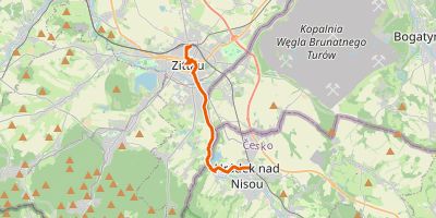
GR-HUWALong Distance Trail (GR)·Linear
GR-HuWa - Hugenotten- und Waldenserpfad (Abstecher Bad Homburg)
Bad Homburg vor der Höhe, Hesse
Easy4.8/100Year-round
Distance
2.4 km
Est. duration
40min
Elevation gain
+36 m
Elevation loss
-24 m
Highest point
206 m
Lowest point
180 m
Average elevation
189 m
Elevation profile
Flat (≤1%)Gentle (1–5%)Steep (5–10%)Extreme (≥10%)
Flat (≤1%)
Gentle (1–5%)
Steep (5–10%)
Extreme (≥10%)
7-Day Forecast
Slope distribution
Flat (≤1%)63%Gentle (1–5%)22%Steep (5–10%)11%Extreme (≥10%)5%
Child-friendlyYes
Pet-friendlyYes
- 👟Light hiking shoesFootwearRecommended
- 💧Carry 2–3 L (no water sources on route)WaterEssential
- 🧴Sunscreen recommendedSun protectionRecommended
Similar trails
GR-I24Easy
GR-I24 - Svatojakubská cesta, Žitavská trasa, Zittau - Hrádek n. Nisou
8.8 km+79 m2h 20minLinear
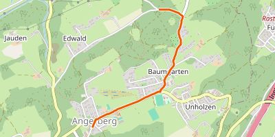
GR-JBBTEasy
GR-JBBT - Jakobsweg Böhmen-Bayern-Tirol VarianteBaumgarten
1.8 km+33 m30minLinear
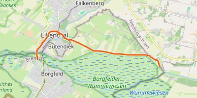
GR-JW-VBEasy
GR-Jw vB - Jakobsweg via Baltica, Niedersachsen, Abzweig Lilienthal
7.4 km+37 m1h 55minLinear
| Start municipality | Bad Homburg vor der Höhe |
| Region | Hesse |
| Start | 50.22715, 8.61169Open in maps |
| End | 50.23079, 8.59419 |
| Track points | 180 |